3D model of Okhtyrka — buy a printed city map
Want to buy a 3D model of Okhtyrka or order a map of your own neighbourhood? We print tactile maps from real OpenStreetMap data: streets, buildings with real heights, parks and water. Pick the area in the builder, preview it for free and order the print.
Maps from ≈€8, map keychains from ≈€4. Production takes 2–4 working days. You can also buy just the 3MF file to print yourself.
Okhtyrka is a city in Sumy Oblast with 46,660 residents (2022) and about 1,465 people/km². Sumy lies 67 km to the north.
On a 3D map the city is recognised first by its water (Vorskla) — the anchors people look for first.
The city covers about 32 km², so the centre with its main streets fits one 11–15 cm map with full detail.
Okhtyrka was founded in 1641 on the Vorskla river, 67 kilometres from Sumy. It was once a Cossack regimental centre, and today people know it as one of the towns that took the first blow in 2022 and held. About 46660 people lived here that year, on 31.86 square kilometres.
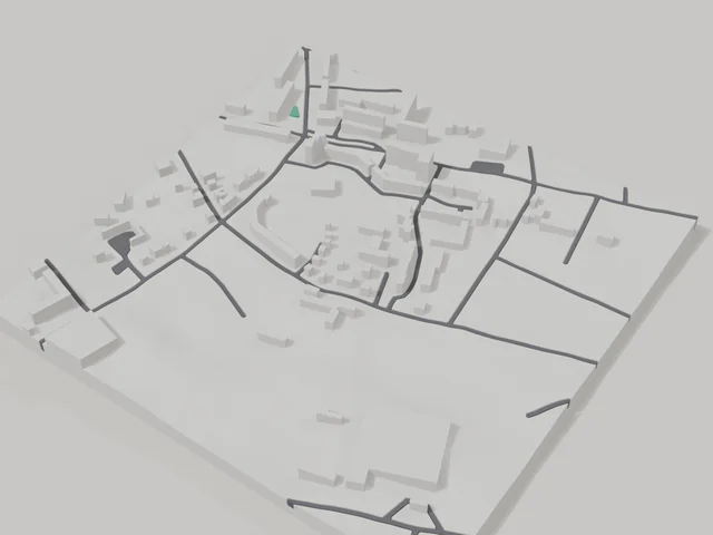
The 800 by 800 metre model square holds 103 buildings. The average height is 5 floors and the tallest buildings have 9 floors, so the blocks come out tall and clear on the map. The Okhtyrka river is printed in a separate water colour. Buildings on the model keep their real height from OSM data, and you can move the frame in the builder right onto your own house.
Okhtyrka at a glance
- Population
- 46,660 (2022)
- Area
- 32 km²
- Density
- 1,465 people/km²
- Region
- Sumy Oblast
- Water
- Vorskla
- Founded
- 1641
What your 3D model of Okhtyrka will show
An 800 × 800 m square around the centre of Okhtyrka holds about 103 buildings, each with its real height. The tallest building in frame has 9 floors, 5 on average.
What the area is like: mid-rise blocks — buildings read clearly one by one; an open area with plenty of free space.
Water in frame: Охтирка — slightly lower than the ground, so the shoreline reads in relief.
Recognisable places inside the area: Пам'ятник Чорнобильцям.
Data: OpenStreetMap, 800 × 800 m area.
How to order a 3D map of Okhtyrka
- Open the builder — it starts right at the centre of Okhtyrka. Move the frame to your district, street or yard.
- Choose size and style (with or without relief) — the preview is ready in a few minutes.
- Order the print and enter the delivery details — we print it in 2–4 working days.
Prices — Okhtyrka
- Mapa 3D de ciudad — S (≈5,5 cm)350 ₴ · ≈8 €
- Mapa 3D de ciudad — M (≈8 cm)500 ₴ · ≈12 €
- Mapa 3D de ciudad — L (≈11 cm)750 ₴ · ≈18 €
- Mapa 3D de ciudad — XL (≈15 cm)1250 ₴ · ≈30 €
- Mapa 3D de ciudad — 20 cm1650 ₴ · ≈40 €
- Relieve del terreno (opción)+100 ₴
- Imán-mapa de nevera (≈6 cm)210 ₴ · ≈5 €
- Llavero-mapa (impresión 3D)desde 170 ₴ · ≈4 €
FAQ
- How many buildings will the 3D model of Okhtyrka have?
- An 8 cm map of an 800 × 800 m area holds about 103 buildings, the tallest with 9 floors. Resize or move the frame and the count changes — the builder preview shows the exact result.
- Will Пам'ятник Чорнобильцям be visible on the model?
- Yes — Пам'ятник Чорнобильцям lies inside the area shown for this page. Move the frame in the builder to put it right in the centre.
- ¿Qué zona de Okhtyrka conviene elegir?
- Las zonas mixtas quedan mejor: algunas calles, un parque o agua — el distrito sigue siendo reconocible a primera vista. Una zona demasiado grande hace los detalles muy pequeños.
- ¿Cómo es el envío a Okhtyrka?
- Envío por Nova Poshta en Ucrania. El coste de envío se cobra aparte según la tarifa del transportista.