3D model of Pryluky — buy a printed city map
Want to buy a 3D model of Pryluky or order a map of your own neighbourhood? We print tactile maps from real OpenStreetMap data: streets, buildings with real heights, parks and water. Pick the area in the builder, preview it for free and order the print.
Maps from ≈€8, map keychains from ≈€4. Production takes 2–4 working days. You can also buy just the 3MF file to print yourself.
Pryluky is a city in Chernihiv Oblast with 53,395 residents (2020) and about 1,271 people/km². Chernihiv lies 127 km to the north-west.
On a 3D map the city is recognised first by its water (Udai) — the anchors people look for first.
At 42 km² the whole city will not fit one model — people usually pick the centre or their own neighbourhood at 8–11 cm.
Pryluky stands on the Udai river 127 kilometres from Chernihiv, and the first mention of the town dates to 1085. In Cossack times it was a regimental centre, and old churches and merchant houses still stand in the town. About 53395 people lived here according to 2020 data, on 42 square kilometres.
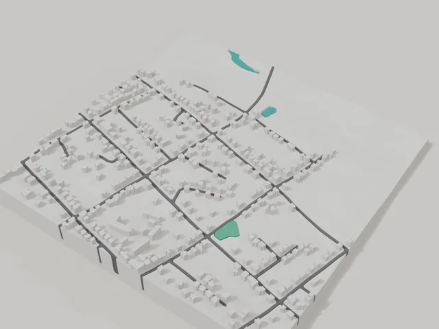
The 800 by 800 metre model square holds 731 buildings, so the centre of Pryluky comes out dense and detailed. The Udai river is printed in a separate water colour and curves around the town, which is visible even on an 8 cm model. If another corner of the town is closer to you, move the frame in the builder right onto your own house.
Pryluky at a glance
- Population
- 53,395 (2020)
- Area
- 42 km²
- Density
- 1,271 people/km²
- Region
- Chernihiv Oblast
- Water
- Udai
- First mentioned
- 1085
What your 3D model of Pryluky will show
An 800 × 800 m square around the centre of Pryluky holds about 731 buildings, each with its real height.
What the area is like: a very dense area — the model will be packed with detail.
Water in frame: Удай — slightly lower than the ground, so the shoreline reads in relief.
Data: OpenStreetMap, 800 × 800 m area.
How to order a 3D map of Pryluky
- Open the builder — it starts right at the centre of Pryluky. Move the frame to your district, street or yard.
- Choose size and style (with or without relief) — the preview is ready in a few minutes.
- Order the print and enter the delivery details — we print it in 2–4 working days.
Prices — Pryluky
- Mapa 3D de ciudad — S (≈5,5 cm)350 ₴ · ≈8 €
- Mapa 3D de ciudad — M (≈8 cm)500 ₴ · ≈12 €
- Mapa 3D de ciudad — L (≈11 cm)750 ₴ · ≈18 €
- Mapa 3D de ciudad — XL (≈15 cm)1250 ₴ · ≈30 €
- Mapa 3D de ciudad — 20 cm1650 ₴ · ≈40 €
- Relieve del terreno (opción)+100 ₴
- Imán-mapa de nevera (≈6 cm)210 ₴ · ≈5 €
- Llavero-mapa (impresión 3D)desde 170 ₴ · ≈4 €
FAQ
- How many buildings will the 3D model of Pryluky have?
- An 8 cm map of an 800 × 800 m area holds about 731 buildings. Resize or move the frame and the count changes — the builder preview shows the exact result.
- ¿Cómo pago un pedido?
- Pago con tarjeta en línea (Visa/Mastercard vía LiqPay) o contra reembolso — a tu elección al finalizar.
- ¿Qué zona de Pryluky conviene elegir?
- Las zonas mixtas quedan mejor: algunas calles, un parque o agua — el distrito sigue siendo reconocible a primera vista. Una zona demasiado grande hace los detalles muy pequeños.