3D model of Luhansk — buy a printed city map
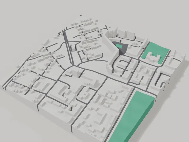
The 3D map of Luhansk is printed from open map data: buildings get their real height, roads their width, parks and water a colour of their own. Any part of the city can be ordered, from the centre to the outskirts.
Maps from ≈€8, map keychains from ≈€4. Production takes 2–4 working days. You can also buy just the 3MF file to print yourself.
Luhansk is a city in Luhansk Oblast with 403,938 residents (2019) and about 1,572 people/km². Kharkiv lies 273 km to the north-west.
On a 3D map the city is recognised first by its water (Luhan) and its landmark, Volodymyr Dahl Museum — the anchors people look for first.
The city is large (257 km²), so a single district or street works best; for the whole city, a multi-tile panel.
Luhansk was founded in 1795 on the Luhan river, and an estimate from 2019 put its population at about 404 thousand. One of the city's best known addresses is linked to Volodymyr Dahl, and the city has a museum bearing his name. The area for the 3D map is an 800 by 800 metre square in the centre: 263 buildings, 1.9 floors on average, the tallest at 12 floors.
The frame includes the Holy Kazan Church and the Foundry Worker monument, as well as the music building of the culture academy. A map of Luhansk is most often ordered as a keepsake of home: move the frame in the builder onto your street, yard or school and the model shows them with real building heights. Buy a 3D model of the centre or order a map of your own block for yourself or as a gift; the preview is free.
Luhansk at a glance
- Population
- 403,938 (2019)
- Area
- 257 km²
- Density
- 1,572 people/km²
- Region
- Luhansk Oblast
- Water
- Luhan
- Landmark
- Volodymyr Dahl Museum
- Founded
- 1795
What your 3D model of Luhansk will show
An 800 × 800 m square around the centre of Luhansk holds about 263 buildings, each with its real height. The tallest building in frame has 12 floors, 1.9 on average.
What the area is like: low-rise blocks — streets and terrain show especially well.
Green areas printed in a separate colour: сквер Молодої гвардії, Красна площа.
Recognisable places inside the area: Музичнийи корпус ЛДАКІ, Свято-Казанський храм, Пам'ятник ливарнику, Чорнобильцям, Я люблю Луганськ, Алея парасольок.
Data: OpenStreetMap, 800 × 800 m area.
How to order a 3D map of Luhansk
- Open the builder — it starts right at the centre of Luhansk. Move the frame to your district, street or yard.
- Choose size and style (with or without relief) — the preview is ready in a few minutes.
- Order the print and enter the delivery details — we print it in 2–4 working days.
Prices — Luhansk
- Mapa 3D miasta — S (≈5,5 cm)350 ₴ · ≈8 €
- Mapa 3D miasta — M (≈8 cm)500 ₴ · ≈12 €
- Mapa 3D miasta — L (≈11 cm)750 ₴ · ≈18 €
- Mapa 3D miasta — XL (≈15 cm)1250 ₴ · ≈30 €
- Mapa 3D miasta — 20 cm1650 ₴ · ≈40 €
- Relief terenu (opcja)+100 ₴
- Magnes-mapa na lodówkę (≈6 cm)210 ₴ · ≈5 €
- Brelok-mapa (druk 3D)od 170 ₴ · ≈4 €
FAQ
- How many buildings will the 3D model of Luhansk have?
- An 8 cm map of an 800 × 800 m area holds about 263 buildings, the tallest with 12 floors. Resize or move the frame and the count changes — the builder preview shows the exact result.
- Will Музичнийи корпус ЛДАКІ be visible on the model?
- Yes — Музичнийи корпус ЛДАКІ lies inside the area shown for this page. Move the frame in the builder to put it right in the centre.
- Ile trwa wykonanie?
- Wykonanie mapy lub breloka z dzielnicą miasta Luhansk zajmuje 2–4 dni robocze, po czym model trafia do wysyłki.
- Czy można dodać napis z tyłu?
- Tak — z tyłu breloka lub mapy można dodać własny tekst: imię, datę, współrzędne lub nazwę miasta. Opcja dostępna w kreatorze przed zamówieniem.