3D model of Vyshneve — buy a printed city map
Want to buy a 3D model of Vyshneve or order a map of your own neighbourhood? We print tactile maps from real OpenStreetMap data: streets, buildings with real heights, parks and water. Pick the area in the builder, preview it for free and order the print.
Maps from ≈€8, map keychains from ≈€4. Production takes 2–4 working days. You can also buy just the 3MF file to print yourself.
Vyshneve is a city in Kyiv Oblast with 40,919 residents (2019) and about 1,624 people/km². Kyiv lies 13 km to the north-east.
The city covers about 25 km², so the centre with its main streets fits one 11–15 cm map with full detail.
Vyshneve lies 13 kilometres southwest of Kyiv and has practically merged with the capital. The settlement is known from 1887, when a station appeared by the railway, and today it is a town of new residential complexes. About 40919 people lived here according to 2019 data, on 25.2 square kilometres.
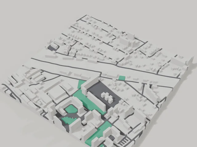
The 800 by 800 metre model square holds 444 buildings. The average height is the highest among the small towns on our site at 7.6 floors, and the tallest building has 21 floors, so the model comes out tall, with towers standing out among private houses. Buildings on the model keep their real height, and you can move the frame right onto your own complex.
Vyshneve at a glance
- Population
- 40,919 (2019)
- Area
- 25 km²
- Density
- 1,624 people/km²
- Region
- Kyiv Oblast
- Founded
- 1887
What your 3D model of Vyshneve will show
An 800 × 800 m square around the centre of Vyshneve holds about 444 buildings, each with its real height. The tallest building in frame has 21 floors, 7.6 on average.
What the area is like: mid-rise blocks — buildings read clearly one by one.
Data: OpenStreetMap, 800 × 800 m area.
How to order a 3D map of Vyshneve
- Open the builder — it starts right at the centre of Vyshneve. Move the frame to your district, street or yard.
- Choose size and style (with or without relief) — the preview is ready in a few minutes.
- Order the print and enter the delivery details — we print it in 2–4 working days.
Prices — Vyshneve
- Carte 3D de ville — S (≈5,5 cm)350 ₴ · ≈8 €
- Carte 3D de ville — M (≈8 cm)500 ₴ · ≈12 €
- Carte 3D de ville — L (≈11 cm)750 ₴ · ≈18 €
- Carte 3D de ville — XL (≈15 cm)1250 ₴ · ≈30 €
- Carte 3D de ville — 20 cm1650 ₴ · ≈40 €
- Relief du terrain (option)+100 ₴
- Aimant-carte de frigo (≈6 cm)210 ₴ · ≈5 €
- Porte-clés carte (impression 3D)dès 170 ₴ · ≈4 €
FAQ
- How many buildings will the 3D model of Vyshneve have?
- An 8 cm map of an 800 × 800 m area holds about 444 buildings, the tallest with 21 floors. Resize or move the frame and the count changes — the builder preview shows the exact result.
- Quel quartier de Vyshneve choisir ?
- Les zones variées rendent le mieux : quelques rues, un parc ou de l'eau — le quartier reste reconnaissable au premier coup d'œil. Une zone trop grande rend les détails trop petits.
- Comment se passe la livraison vers Vyshneve ?
- Livraison par Nova Poshta en Ukraine. Les frais de port sont facturés séparément au tarif du transporteur.