3D model of Izium — buy a printed city map
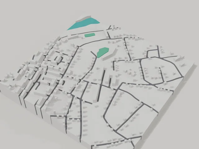
The 3D map of Izium is printed from open map data: buildings get their real height, roads their width, parks and water a colour of their own. Any part of the city can be ordered, from the centre to the outskirts.
Maps from ≈€8, map keychains from ≈€4. Production takes 2–4 working days. You can also buy just the 3MF file to print yourself.
Izium is a city in Kharkiv Oblast with 45,884 residents (2021) and about 105 people/km². Kharkiv lies 117 km to the north-west.
On a 3D map the city is recognised first by its water (Siverskyi Donets) and its landmark, Kremenets Hill — the anchors people look for first.
The city is large (436 km²), so a single district or street works best; for the whole city, a multi-tile panel.
Izium was founded in 1681 on the Siverskyi Donets, 117 kilometres from Kharkiv. Kremenets hill rises above the town and gives a view over the whole river valley. The town covers 436 square kilometres including forests and meadows, so density is low at 105 people per square kilometre. In 2022 Izium went through occupation and was liberated that autumn.
About 45884 people lived here according to 2021 data. The 800 by 800 metre model square holds 304 buildings with an average of 2.5 floors and the tallest at 5 floors. Among them are the local history museum and the Church of the Exaltation of the Cross. You can move the frame onto your street and add an inscription or a date on the back.
Izium at a glance
- Population
- 45,884 (2021)
- Area
- 436 km²
- Density
- 105 people/km²
- Region
- Kharkiv Oblast
- Water
- Siverskyi Donets
- Landmark
- Kremenets Hill
- Founded
- 1681
What your 3D model of Izium will show
An 800 × 800 m square around the centre of Izium holds about 304 buildings, each with its real height. The tallest building in frame has 5 floors, 2.5 on average.
What the area is like: low-rise blocks — streets and terrain show especially well.
Recognisable places inside the area: Пам'ятник Князю Ігорю Святославичу, Меморіальна дошка 8-му (521-му) окремому саперному батальйону., Краєзнавчий музей, Хрестовоздвиженська церква.
Data: OpenStreetMap, 800 × 800 m area.
How to order a 3D map of Izium
- Open the builder — it starts right at the centre of Izium. Move the frame to your district, street or yard.
- Choose size and style (with or without relief) — the preview is ready in a few minutes.
- Order the print and enter the delivery details — we print it in 2–4 working days.
Prices — Izium
- Carte 3D de ville — S (≈5,5 cm)350 ₴ · ≈8 €
- Carte 3D de ville — M (≈8 cm)500 ₴ · ≈12 €
- Carte 3D de ville — L (≈11 cm)750 ₴ · ≈18 €
- Carte 3D de ville — XL (≈15 cm)1250 ₴ · ≈30 €
- Carte 3D de ville — 20 cm1650 ₴ · ≈40 €
- Relief du terrain (option)+100 ₴
- Aimant-carte de frigo (≈6 cm)210 ₴ · ≈5 €
- Porte-clés carte (impression 3D)dès 170 ₴ · ≈4 €
FAQ
- How many buildings will the 3D model of Izium have?
- An 8 cm map of an 800 × 800 m area holds about 304 buildings, the tallest with 5 floors. Resize or move the frame and the count changes — the builder preview shows the exact result.
- Will Пам'ятник Князю Ігорю Святославичу be visible on the model?
- Yes — Пам'ятник Князю Ігорю Святославичу lies inside the area shown for this page. Move the frame in the builder to put it right in the centre.
- Combien de temps prend la fabrication ?
- La fabrication d'une carte ou d'un porte-clés avec un quartier de Izium prend 1 à 3 jours ouvrés, puis le modèle part en livraison.
- Puis-je ajouter du texte au dos ?
- Oui — le dos d'un porte-clés ou d'une carte peut porter votre texte : un nom, une date, des coordonnées ou un nom de ville. L'option est dans le configurateur avant la commande.