3D model of Myrhorod — buy a printed city map
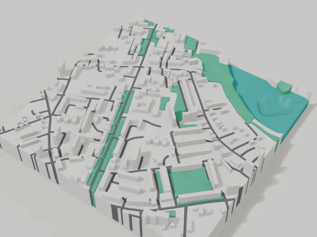
The 3D map of Myrhorod is printed from open map data: buildings get their real height, roads their width, parks and water a colour of their own. Any part of the city can be ordered, from the centre to the outskirts.
Maps from ≈€8, map keychains from ≈€4. Production takes 2–4 working days. You can also buy just the 3MF file to print yourself.
Myrhorod is a city in Poltava Oblast with 40,160 residents (2017) and about 2,114 people/km². Poltava lies 79 km to the south-east.
On a 3D map the city is recognised first by its water (Khorol) and its landmark, Myrhorod spa resort — the anchors people look for first.
The city covers about 19 km², so the centre with its main streets fits one 11–15 cm map with full detail.
Myrhorod stands on the Khorol river 79 kilometres from Poltava, and the first mention of the town dates to 1575. Gogol made it famous with his story collection named after the town, and today it is known as a spa resort with mineral water. About 40160 people lived here according to the 2017 estimate, on 19 square kilometres.
The 800 by 800 metre model square holds 218 buildings with an average of 3.9 floors and the tallest at 10 floors. The Khorol river is printed in a separate water colour, and the area includes the local history museum, a monument to the Cossacks and the literary memorial museum of Davyd Guramishvili. Buildings on the model keep their real height.
Myrhorod at a glance
- Population
- 40,160 (2017)
- Area
- 19 km²
- Density
- 2,114 people/km²
- Region
- Poltava Oblast
- Water
- Khorol
- Landmark
- Myrhorod spa resort
- First mentioned
- 1575
What your 3D model of Myrhorod will show
An 800 × 800 m square around the centre of Myrhorod holds about 218 buildings, each with its real height. The tallest building in frame has 10 floors, 3.9 on average.
What the area is like: low-rise blocks — streets and terrain show especially well.
Water in frame: Хорол — slightly lower than the ground, so the shoreline reads in relief.
Recognisable places inside the area: Миргородський краєзнавчий музей, Літературно-меморіальний музей Давида Гурамішвілі, Давид Гурамішвілі, Пам'ятник Козакам, Пам'ятник В.М. Боровиковському.
Data: OpenStreetMap, 800 × 800 m area.
How to order a 3D map of Myrhorod
- Open the builder — it starts right at the centre of Myrhorod. Move the frame to your district, street or yard.
- Choose size and style (with or without relief) — the preview is ready in a few minutes.
- Order the print and enter the delivery details — we print it in 2–4 working days.
Prices — Myrhorod
- 3D-Stadtkarte — S (≈5,5 cm)350 ₴ · ≈8 €
- 3D-Stadtkarte — M (≈8 cm)500 ₴ · ≈12 €
- 3D-Stadtkarte — L (≈11 cm)750 ₴ · ≈18 €
- 3D-Stadtkarte — XL (≈15 cm)1250 ₴ · ≈30 €
- 3D-Stadtkarte — 20 cm1650 ₴ · ≈40 €
- Geländerelief (Option)+100 ₴
- Kühlschrankmagnet-Karte (≈6 cm)210 ₴ · ≈5 €
- Karten-Schlüsselanhänger (3D-Druck)ab 170 ₴ · ≈4 €
FAQ
- How many buildings will the 3D model of Myrhorod have?
- An 8 cm map of an 800 × 800 m area holds about 218 buildings, the tallest with 10 floors. Resize or move the frame and the count changes — the builder preview shows the exact result.
- Will Миргородський краєзнавчий музей be visible on the model?
- Yes — Миргородський краєзнавчий музей lies inside the area shown for this page. Move the frame in the builder to put it right in the centre.
- Wie lange dauert die Herstellung?
- Die Herstellung einer Karte oder eines Anhängers mit einem Viertel von Myrhorod dauert 2–4 Werktage, danach geht das Modell in den Versand.
- Kann ich Text auf die Rückseite setzen?
- Ja — auf die Rückseite eines Anhängers oder einer Karte kommt dein eigener Text: ein Name, ein Datum, Koordinaten oder ein Stadtname. Die Option gibt es im Konfigurator vor dem Checkout.