3D model of Chornomorsk — buy a printed city map
A model of Chornomorsk is not an off-the-shelf souvenir — it is your own place: your yard, street or district. You choose the area, see a free preview straight away and we ship the printed 3D map.
Maps from ≈€8, map keychains from ≈€4. Production takes 2–4 working days. You can also buy just the 3MF file to print yourself.
Chornomorsk is a city in Odesa Oblast with 57,983 residents (2022) and about 2,319 people/km². Odesa lies 21 km to the north.
On a 3D map the city is recognised first by its water (Black Sea) and its landmark, Seaport — the anchors people look for first.
The city covers about 25 km², so the centre with its main streets fits one 11–15 cm map with full detail.
Chornomorsk lies on the Black Sea coast 21 kilometres from Odesa. The town was founded in 1952 together with its sea port, which is still its main business. About 57983 people lived here in 2022, on 25 square kilometres.
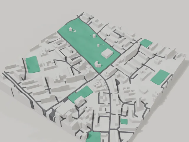
The 800 by 800 metre model square holds 141 buildings. The average height is 3.7 floors and the tallest building has 14 floors, so the map clearly shows the contrast between tower blocks and the private houses near the sea. Molodizhnyi park is printed in green, and the coastline appears in a separate water colour. You can move the frame closer to the port or onto your own building.
Chornomorsk at a glance
- Population
- 57,983 (2022)
- Area
- 25 km²
- Density
- 2,319 people/km²
- Region
- Odesa Oblast
- Water
- Black Sea
- Landmark
- Seaport
- Founded
- 1952
What your 3D model of Chornomorsk will show
An 800 × 800 m square around the centre of Chornomorsk holds about 141 buildings, each with its real height. The tallest building in frame has 14 floors, 3.7 on average.
What the area is like: low-rise blocks — streets and terrain show especially well; an open area with plenty of free space.
Green areas printed in a separate colour: Молодіжний парк.
Recognisable places inside the area: Скеля з овном, Іллічівський інститут ОНУ.
Data: OpenStreetMap, 800 × 800 m area.
How to order a 3D map of Chornomorsk
- Open the builder — it starts right at the centre of Chornomorsk. Move the frame to your district, street or yard.
- Choose size and style (with or without relief) — the preview is ready in a few minutes.
- Order the print and enter the delivery details — we print it in 2–4 working days.
Prices — Chornomorsk
- 3D-Stadtkarte — S (≈5,5 cm)350 ₴ · ≈8 €
- 3D-Stadtkarte — M (≈8 cm)500 ₴ · ≈12 €
- 3D-Stadtkarte — L (≈11 cm)750 ₴ · ≈18 €
- 3D-Stadtkarte — XL (≈15 cm)1250 ₴ · ≈30 €
- 3D-Stadtkarte — 20 cm1650 ₴ · ≈40 €
- Geländerelief (Option)+100 ₴
- Kühlschrankmagnet-Karte (≈6 cm)210 ₴ · ≈5 €
- Karten-Schlüsselanhänger (3D-Druck)ab 170 ₴ · ≈4 €
FAQ
- How many buildings will the 3D model of Chornomorsk have?
- An 8 cm map of an 800 × 800 m area holds about 141 buildings, the tallest with 14 floors. Resize or move the frame and the count changes — the builder preview shows the exact result.
- Will Скеля з овном be visible on the model?
- Yes — Скеля з овном lies inside the area shown for this page. Move the frame in the builder to put it right in the centre.
- Kann ich Text auf die Rückseite setzen?
- Ja — auf die Rückseite eines Anhängers oder einer Karte kommt dein eigener Text: ein Name, ein Datum, Koordinaten oder ein Stadtname. Die Option gibt es im Konfigurator vor dem Checkout.
- Wie bezahle ich eine Bestellung?
- Kartenzahlung online (Visa/Mastercard über LiqPay) oder Nachnahme — deine Wahl beim Checkout.